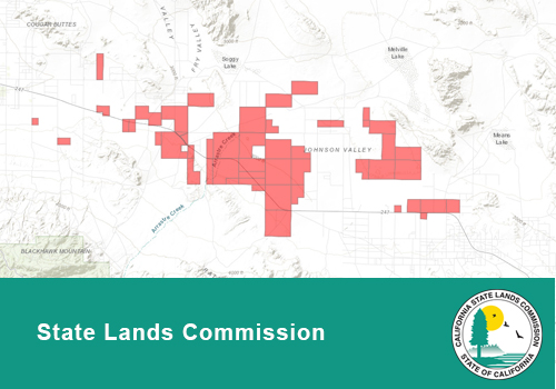
The data found in this map were created to depict state-owned School Lands that are under the jurisdiction of the California State Lands Commission. This data covers the entire State of California.
The California State Lands Commission (CSLC) was created by the California Legislature in 1938 and given the authority and responsibility to manage certain public lands within the state. The public lands under the Commission’s jurisdiction are of two distinct types—sovereign lands acquired upon California’s admission into the Union in 1850; and certain federally granted lands including school lands, and swamp and overflowed lands.
The data included in this map pertains to school lands. These are what remain of the nearly 5.5 million acres throughout the state originally granted to California by Congress in 1853 to benefit public education.